Software & Accessories
Our Products
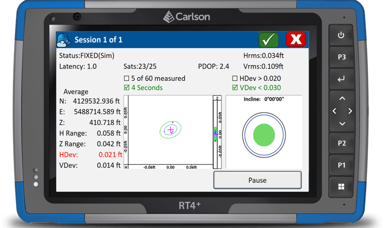
Carlson SurvPC - SurcCE - Field
There’s a reason surveyors make Carlson their first choice in data collection software. SurvPC (for Windows) and SurvCE (for Windows Mobile) combine advanced functionality, ease-of-use, and cutting-edge features with excellent service and award-winning technical support.
Both SurvPC and SurvCE support the widest range of popular and newly released RTK GPS and conventional and robotic total stations, putting the power of Carlson’s in-field coordinate geometry at your fingertips.
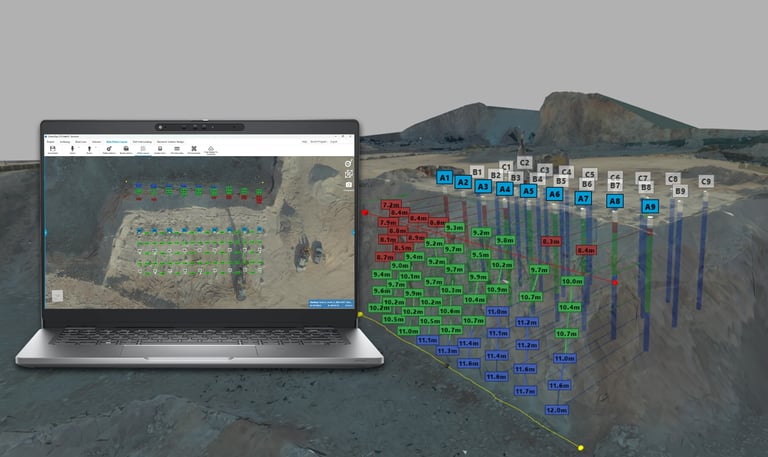
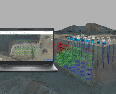
Improve blasts with better rock fragmentation, reduce the possibility of fly rock, and lower operational costs. Carlson BlastOPS supports the precision and calculation necessary for the utmost blast efficiency. Work with point clouds to develop meshes, create blast pattern layouts, and ensure proper burden and borehole spacing for more productive blasting and project site optimization.
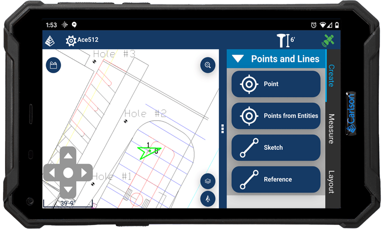
Carlson Layout - Field
CarlsonOPS - Office
Carlson Scan - Office
Carlson Command - Office
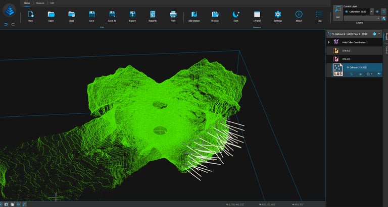
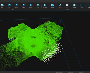
Carlson Scan is the free operational software for the Boretrak®3, C-ALS®, and Void Scanner+ (VS+). It enables full control and function of each system and can run on a Windows-based laptop, Android-based mobile device, or tablet. Scans are displayed in real-time as data is collected with both points and a solid mesh available to view.
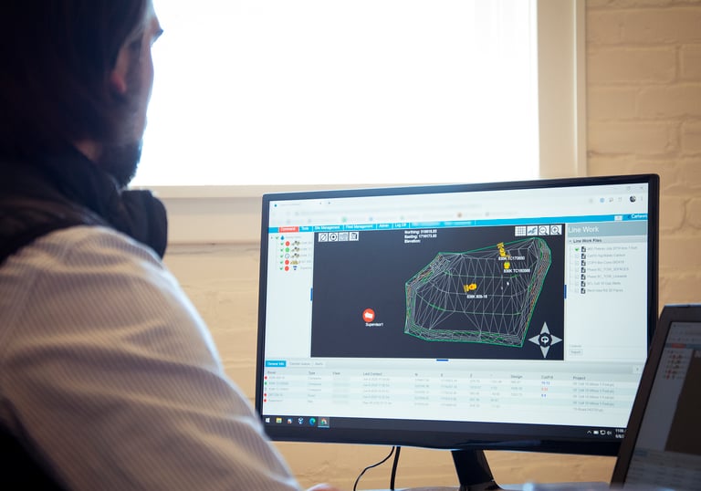
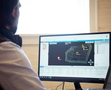
Carlson Command is a monitoring and data management software solution that transmits data from the machines to Command and from Command to the machines, increasing both safety, productivity, and reporting capabilities.
On both large and small job-sites, managers can see and monitor multiple or single machines in multiple views, including a plan view, from any location with an internet connection. Machine positions can be viewed, cut/fill and elevation monitored in real-time, and managers can remote into the machine and send messages.
The Android-based Carlson Layout provides an efficient, affordable, and easy-to-use site layout solution, backed with excellent service and award-winning technical support.
Unlike any other available solution, Layout supports the widest range of popular and newly released RTK GPS and conventional and robotic total stations, putting the power of Carlson’s in-field coordinate geometry at your fingertips.