Carlson Survey
Carlson Survey is designed to complement land surveying operations and provides a variety of survey features to process data from surface modeling to Least Squares Network Adjustment. Users work seamlessly between the office and the field by utilizing company-wide design styles for ease of use and efficiency.
Choose your platform – Carlson Survey works on:
■ IntelliCAD® (built-in)
■ AutoCAD® OEM (built-in)
■ AutoCAD® (sold separately)
View the system/hardware requirements for Carlson Survey and our other CAD-based software here.


Survey
Data Collection Interfaces
Upload and download to popular data collectors
Traverse Adjustment
Spreadsheet editor for raw data with graphics and processing for traverse adjustments
SurvNET
Advanced network least-squares for total station, GPS and level data
Field-to-Finish
Draw points with styles and in point groups set by point descriptions and draw linework by several flexible methods
Field-to-Finish Inspector
Inspect all field-to-finish elements, see description source and re-draw based on descriptions edits
COGO
Streamlined inverse, traverse, sideshot, intersections, interpolation, translate, rotate, scale and align
Coordinate Transformations
Transform coordinates and screen entities between lat/lon and grid projections as well as local to local by Helmert and least-squares methods
Deeds
Enter deed by description, read deed data from deed file, deed reports, deed correlation and generate legal description from drawing
Cut Sheets
Create custom cut sheet reports with reference grades and station-offsets


Points
Import/Export
User-defined import and export of point data along with conversions with specific other formats
Draw Points
Draw points with settings for symbols, layers and styles
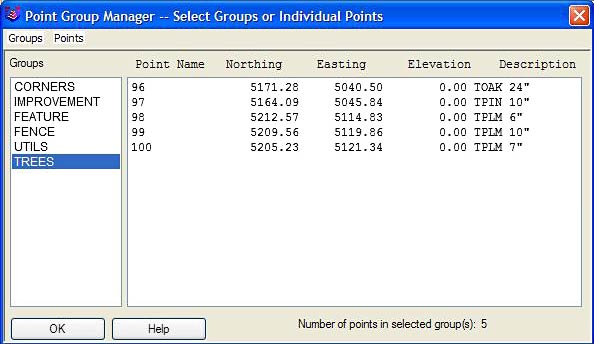
Point Groups
Point group manager to define sets of point by filters
Coordinate File History
Tracks all changes to points with report and undo functions
Fix Point Label Overlaps
Finds point label overlaps with rule options to fix automatically
Point Tools
Utilities for modify point labels such as move with leader, twist and resize
Annotation
Angle & Distance Labels
Flexible routines to label linework in all possible layout combinations plus available rules to automatically fix label overlaps and revise labels when entities move
Curve Labels
Label curve data in stack, along arc or in table
Survey Text
Routines to create typical plat labels such as offset and building dimensions
Label Elevations
Label spot elevations along an alignment
Line types
Draw special line types
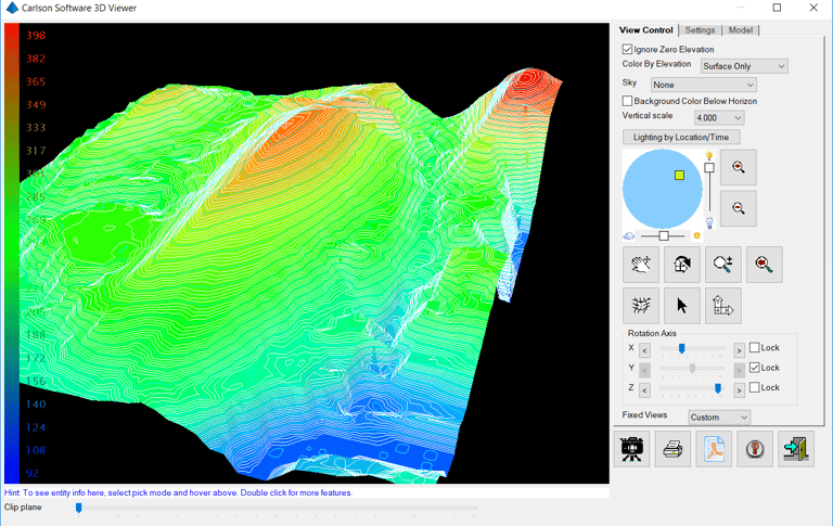
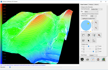
Surfaces
Build Surfaces
By triangulation or rectangular grids
Contouring
One step triangulate and contour from 3D entities as well as contouring from surface files
Surface Manager
Change surface display properties and adjust surface functions to add and remove points and breaklines and swap edges
Volumes
Earthwork volumes between triangulation or grid surfaces
Pad Design
Tie cut/fill slopes from pad perimeter to surface, build pad surface, calculate and balance volumes, and edit pad parameters
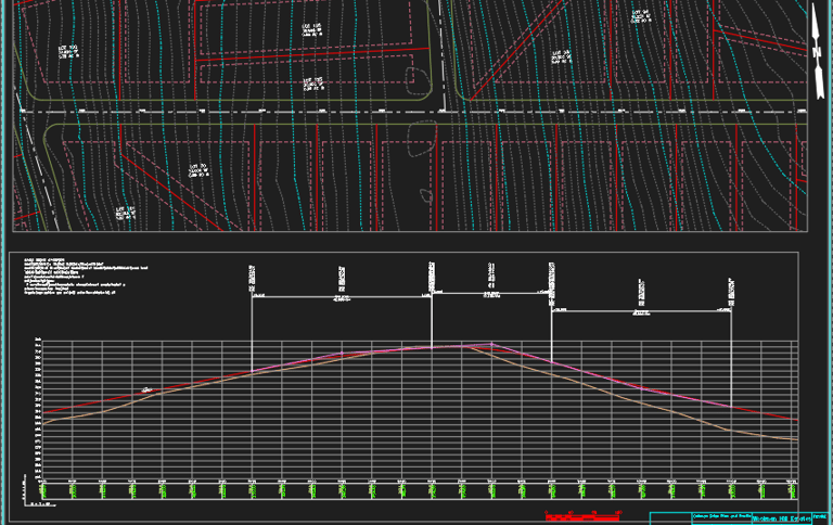
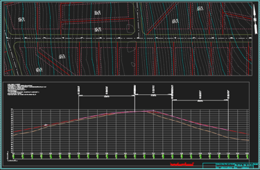
Center-lines & Profiles
Design and Edit Center-lines
Design or input alignments on screen or in dialog with graphics
Label Stations and Offsets
Annotate station and offsets along center-line and at selected points
Calculate Offsets
Reports stations and offsets for selected points along center-line
Create Offset Points
Create points at specified stations and offsets
Spirals
Flexible handling of the most complex spiral curves including spiral-only elements going arc-spiral-arc, arc-spiral-line and line-spiral-line
Create Profiles
From surfaces, screen entities, points on center-line, etc.
Quick Profile
One step profile creation with real-time update while adjusting center-line
Input-Edit Profiles
Enter profile data in dual spreadsheet and graphic window, and design in reference to controlling profile grade points
Draw Profiles
Draws profiles on grids or plan-profile sheets with auto-updating based on edits
Profiles To 3D
Create points and 3D polylines from profiles