Carlson SurvPC/SurvCE
There’s a reason surveyors make Carlson their first choice in data collection software. SurvPC (for Windows) and SurvCE (for Windows Mobile) combine advanced functionality, ease-of-use, and cutting-edge features with excellent service and award-winning technical support.
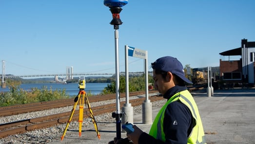
Both SurvPC and SurvCE support the widest range of popular and newly released RTK GPS and conventional and robotic total stations, putting the power of Carlson’s in-field coordinate geometry at your fingertips

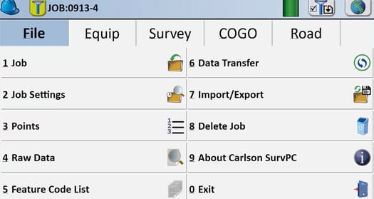
Core Features
• Highly graphical and intuitive user interface is designed ‘by surveyors for surveyors’
• Easy data exchange due to rich support of CAD file formats and .dwg, .dgn, .shp
• Optional Field-to-Finish: Create drawings intuitively and automatically as you work, saving you time back in the office
• Strong GIS features with optional seamless linking to Esri® in SurvPC
• Export directly in KML format for fast control in Google Earth
• Camera integration allowing assignment of picture to points or lines
• More field capabilities with quick and easy volume calculation and ability to generate points from polylines
• True versatility: SurvCE and SurvPC run on hundreds of GPS and total station models in service today, including Altus, Ashtech, Carlson, Geomax, Leica, Pentax, Sokkia, Spectra-Precision, Stonex, Topcon, and more. See full list at www.survce.com.
• SurvCE/PC are available in more than two dozen languages: English, Spanish, German, French, French (Canadian), Russian, Portuguese, Czech, Dutch, Chinese, Korean, Greek, Italian, Polish, Hungarian, Swedish, Latvian and more.
Hybrid+
• Mix and match any RTS and GNSS from Carlson’s vast driver library
• GPS Search is faster than any search method available
• Follow Me keeps the total station pointed where you need it by continuously tracking the GNSS location
• Smart Lock detects when you are slowing down to take a measurement and automatically locks on the prism—ready when you are
• Smart Staking provides directions from the GNSS when the total station position isn’t available, then automatically locks back on the prism when you reach your destination
• Backup Tracking — GPS position is automatically shown when total station is not tracking
• GNSS Sensors work with the total station to allow e-level in total station mode and automatic correction of tilted poles

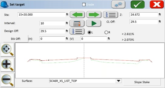
Advanced Roading
• Powerful Roading: favored by U.S. DOTs and heavy highway contractors around the world
• Comprehensive routines: Slope Staking, As-Built Topo with “Store Sections”, and more
• Advanced functionality for staking intersections and
culde-sacs using Carlson Road Network Files
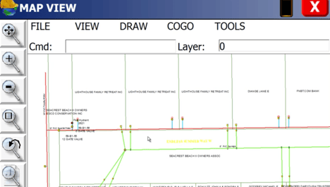
Powered by Esri®
(SurvPC Only)
• Powered by Esri: If ArcMap10, ArcView or equivalent reside on the same Windows tablet, SurvPC ‘finds’ the Esri engine and reads and writes Esri MXD files automatically, or SurvPC can be purchased with an Esri OEM engine built inside
• Intuitively use Esri Maps to perform all survey functions with no downtime learning new software
• Stake out, identify or draw to any existing feature by conventional ‘snap’ selection in Esri, DGN or .dxf
• Create new points in Esri, DGN or .dxf with symbols and formats native to the map
• Learn more in the SurvPC Esri Brochure
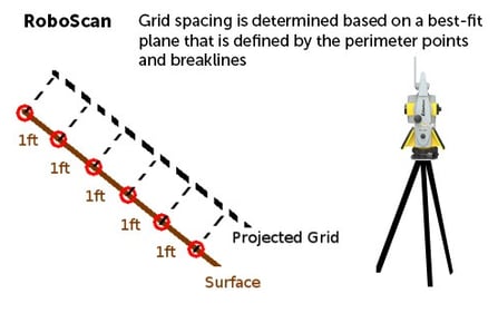
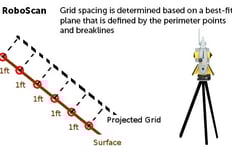
The RoboScan Workflow With Survey Grid
Use your robotic total station as a simple low density grid scanner with the RoboScan Workflow. This powerful tool, available in versions 5.05 and higher, can use the RoboScan Workflow With Grid Scan to take reflectorless shots along a grid that you define, automating the collection of numerous points in a few short steps.